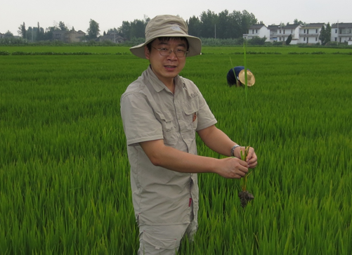
研究员,副所长,农业农村部植物新品种测试(南京)分中心副主任。主要从事农业信息、环境遥感、土地利用变化、农业大数据等领域的科研工作,包括利用多源遥感数据评估江苏省县级尺度主要作物生长情况;应用大数据研究地表覆被在人与自然共同作用下的演化动因和趋势;利用长时序的遥感数据研究岸线变迁对人类活动及自然灾害的响应机制;应用中高分辨率遥感数据监测近岸及内陆水体水质和水环境等。近年来共主持和参与各类国家、省部级课题15项;发表研究论文30余篇,参编专著1部,登记国家软件著作权9项,获省部级二等以上奖励4项。
代表性论文:
1. Lu, Bihui, Kun Yu*,Zhiming Wang, Jing Wang, Jie Shan. Adaptability evaluation of ORYZA (v3) for single-cropped rice under different establishment techniques in eastern China. Agronomy Journal, 2020, 112(4): 2741–2758.
2. Sun, Wei, Jie Shan, Zhiming Wang, Lei Wang, Dianmei Lu, Zhifeng Jin, Kun Yu*. Geospatial Analysis of Urban Expansion Using Remote Sensing Methods and Data: A Case Study of Yangtze River Delta, China. Complexity, 2020, doi:10.1155/2020/3239471.
3. Yu, Kun*,Chuanmin Hu. Long-term vegetation changes in four types of wetland in China and USA between 2000 and 2011: observations from MODIS. International Journal of Remote Sensing, 2019, 40(11):4302-4325.
4. Yu, Kun*,Lin Qiu, Jingjing Wang, Ling Sun, Zhiming wang. Winter wheat straw return monitoring by UAVs observations at different resolutions. International Journal of Remote Sensing,2017, 38:8-10, 2260-2272.
5. Yu, Kun*,Chuanmin Hu. Changes in vegetative coverage of the Hongze Lake national wetland nature reserve: A decadal assessment using MODIS medium-resolution data. Journal of Applied Remote Sensing, 2013, 7(1), 073589, doi: 10.1117/1.JRS.7.073589.
6. Yu, Kun*,Chuanmin Hu, Frank E. Muller-Karger, Dianmei Lu, Inia Soto. Shoreline changes in the west-central Florida between 1987 – 2008 from Landsat observations. International Journal of Remote Sensing,2011, 32(23):8299-8313.
7. Hu, Chuanmin*, Zhongping Lee, Ronghua Ma, Kun Yu, Daqiu Li, Shaoling Shang. Moderate Resolution Imaging Spectroradiometer (MODIS) observations of cyanobacteria blooms in Taihu Lake, China. Journal of Geophysical Research, 2010, 115, C04002, doi:10.1029/2009JC005511.
8. Lu, Bihui, Kun Yu*, Zhiming Wang, Jing Wang, Liangjun Mao. Preliminary Approach on Adaptability of ORYZA2000 Model for Single Cropping Rice in Jiangsu Province (China). The Eighth International Conference On Agro-Geoinformatics, 210-214, Istanbul, Turkey, 2019.07.16-19.
9. Yu, Kun, Zhiming Wang*, Ling Sun, Jing Wang, Jie Shan, Bihui Lu. Crop Phenology Estimation by Time Series MODIS medium-resolution data. The Sixth International Conference On Agro-Geoinformatics, 361-364, Fairfax, USA, 2017.08.07-10.
10. Yu, Kun*, Zhiming Wang, Ling Sun, Jie Shan, Liangjun Mao. Crop growth condition monitoring and analyzing in county scale by time series MODIS medium-resolution data. The Second International Conference On Agro-Geoinformatics, 1-6, Fairfax, USA, 2013.08.12-16, oral presentation at the conference.
11. Yu, Kun*, Dianmei Lu, Zhiming Wang, Jie Shan, Liangjun Mao, Xiaoping Lu, Guiye Bao. Algae blooms in the Yellow Sea between 2010 and 2012 from MODIS observations. The Second International Conference On Agro-Geoinformatics, 365-369, Fairfax, USA, 2013.08.12-16, oral presentation at the conference.
12. 于堃, 单捷,王志明*, 卢必慧, 邱琳, 毛良君. 无人机遥感技术在小尺度土地利用现状动态监测中的应用. 江苏农业学报, 2019, 35(4): 853-859.
13. 于堃*, 王志明, 孙玲, 单捷, 毛良君. MODIS时序数据在县级尺度作物长势监测分析中的应用. 江苏农业学报, 2013,29(6):1278-1290.